Estimated Market Price*: Between $285.00 and $594.00
Map Of Barth, From Civitates Orbis Terrarum By Georg Braun And Frans Hogenberg Circa 1572-1617 Print Details
- Artist
- Joris Hoefnagel
- Artwork
- Map Of Barth, From Civitates Orbis Terrarum By Georg Braun And Frans Hogenberg Circa 1572-1617
- Estimated secondary-market value
- Between $285.00 and $594.00
About this artwork
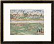
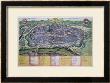
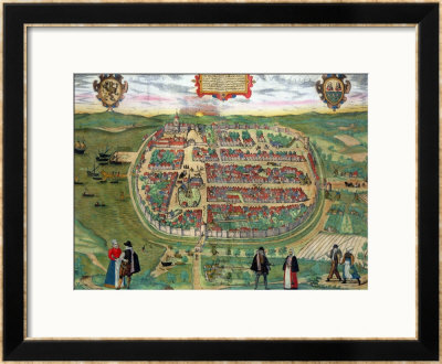
Joris Hoefnagel's Map Of Barth, From Civitates Orbis Terrarum By Georg Braun And Frans Hogenberg Circa 1572-1617 shows an oval walled settlement packed with small red-roofed buildings, bordered by green fields and waterways. Tiny figures stand in the foreground, while boats and two decorative emblems appear near the edges of the scene.
The current estimated secondary-market value for Map Of Barth, From Civitates Orbis Terrarum By Georg Braun And Frans Hogenberg Circa 1572-1617 by Joris Hoefnagel is Between $285.00 and $594.00. This range can be used as a starting point for appraisal and valuation research. A print's final value can vary with its condition, edition details, signature, provenance and recent comparable sales.
This print may be available through the secondary art market. Use the form below to request current pricing or availability, or call 908-264-2807 to discuss Map Of Barth, From Civitates Orbis Terrarum By Georg Braun And Frans Hogenberg Circa 1572-1617 with a secondary-market art broker.
An artwork image is shown when one is available from a gallery. Images remain copyright of their respective copyright holders. Market values can change, and every estimated range is provided as appraisal guidance rather than a guaranteed sale price.
Learn more about the factors behind an estimate in our limited-edition print value and appraisal guide. You can also learn how to research comparable print sales and evaluate condition.